

Bear Creek

Watershed Group

Bear Creek Watershed Project
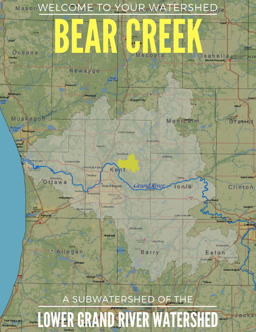
Bear Creek Watershed– HUC Code: 040500060501 (Grand River)
Size and location
The Bear Creek Watershed is a subwatershed of the Grand River Watershed. Bear Creek enters the Grand River about 45 miles upstream of Lake Michigan. By area, the Bear Creek Watershed is about 0.6% of the Grand River Watershed.
The Bear Creek Watershed drains 20,096 acres of rolling hills and steep slopes in northeastern Kent County, Michigan. Although the watershed is located primarily within Cannon Township, approximately 15% lies within Grattan Township, and significantly smaller amounts are within Ada, Vergennes and Plainfield Townships. More than half of Cannon Township (55%) is encompassed by this watershed.
Read the full subwatershed summary here.

A watershed is the area of land that catches rain and snow and drains or seeps into a marsh, stream, river, lake, or groundwater. For example, all of the areas that contribute water to Bear Creek are in the Bear Creek Watershed. Since Bear Creek is part of another watershed, it is not only a watershed, but it is also a sub-watershed. Much of Cannon Township is in the Bear Creek or Rogue River Watersheds. Bear Creek and the Rogue River are sub-watersheds of the Lower Grand River Watershed. Watershed boundaries do not adhere to any city, township, county, state or federal lines and are constantly changing as the land shifts and the course of water moves. No matter where you are, you are in a watershed!
All of Cannon Township is located within the Lower Grand River Watershed. The watershed that occupies the most area in the Township is the Bear Creek Watershed. Sub-watersheds within the Bear Creek Watershed are: Armstrong Creek, Stout Creek, and Waddell Creek. Within the Rogue River watershed and Cannon Township are the Barkley Creek and Rum Creek sub-watersheds. Other sub-watersheds of the Grand River represented in Cannon Township include: Chase Lake, Cowan Lake and Egypt Creek.